World’s Largest Robotic Field Scanner: world record in Maricopa, Arizona
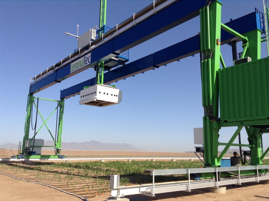
Maricopa, Arizona, United States--The Lemnatec Field Scanalyzer at the USDA Arid Land Research Station in Maricopa, Arizona has a 30-ton steel gantry that autonomously moves along two 200-meter steel rails while continuously imaging the crops growing below it with a diverse array of cameras and sensors; it sets the world record for being the World’s Largest Robotic Field Scanner, according to the WORLD RECORD ACADEMY.
"Mounted on a 30-ton steel gantry moving along 200-meter steel rails over 1.5 acres of energy sorghum, the high-throughput phenotyping robot senses and continuously images the growth and development of the crop, generating an extremely high-resolution, enormous data stream — about 5 terabytes per day," the official website says.
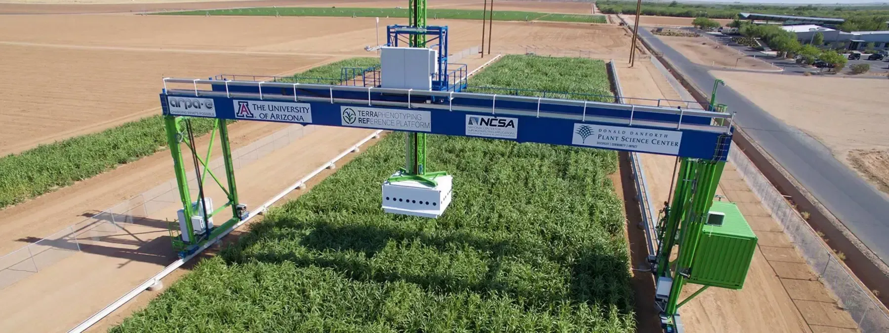
"The Maricopa Agricultural Center looks like a farm, but really it's a laboratory. Having the field scanner here is part of our transformation into the next phase of agriculture," said Shane Burgess, UA vice president for Agriculture, Life and Veterinary Sciences, and Cooperative Extension; dean of the UA College of Agriculture and Life Sciences; and director of the Arizona Experiment Station.
"The LemnaTec Scanalyzer is the largest field crop data acquisition platform in the world," Burgess said. "It's the vanguard of systems integrating phenotype with genotype for improving agricultural production."
"The test plots include 176 lines, cultivars and hybrids of sorghum planted in an area about the size of a football field. About 1.25 acres (30,000 to 40,000 plants) are being scanned, with the data feeding into the onsite Maricopa Phenomics Center, a joint collaboration with USDA-ARS Arid-Land Agricultural Research Center and MAC. The University of Illinois is handling the big-data analytics," the official website says.
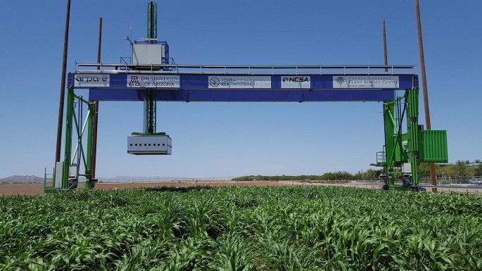
"At 70ft-tall, 92ft-wide and 1,200ft long, the Field Scanalyzer is the world’s largest agricultural robot, the project’s researchers have claimed. Resembling a gantry with a sensor box positioned in the middle, it tends daily to two acres of crops including sorghum, lettuce and wheat, while a cluster of cameras and 3D scanners assess their temperature, shape and hue, and the angle of each leaf," the Robotics & Innovation reports.
"Funded by the US Department of Energy and the Bill and Melinda Gates Foundation, the Field Scanalyzer is currently being tested in Maricopa, Arizona, from where it sends as much as 10TB of data per day to computers in Missouri and Illinois. Scientists at George Washington University and St Louis University are using AI systems including machine-learning and deep-learning algorithms to analyse and draw conclusions about the plants.
"The innovation is described as “an automated robotic field phenotyping platform for detailed crop monitoring”. Phenotyping is the process of predicting a crop’s phenotype – the observable physical properties of an organism – using only genetic information collected from genotyping or DNA sequencing."
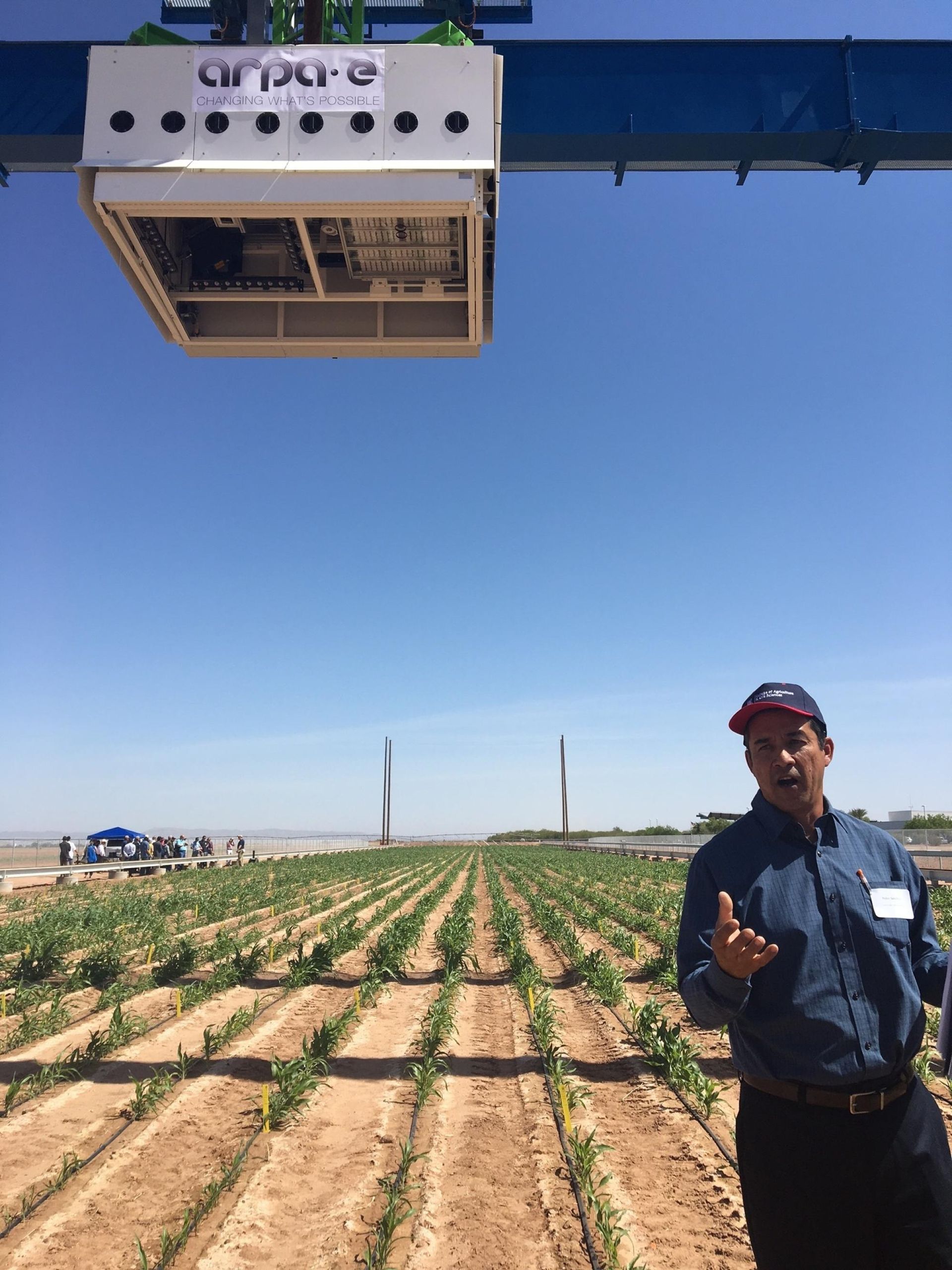
"The 70-foot-tall colossus, called a “Field Scanalyzer,” is the world’s biggest agricultural robot, the project’s researchers say. Resembling an oversize scaffold with a box perched in its middle, it lumbers daily over 2 acres of crops including sorghum, lettuce and wheat, its cluster of electronic eyes assessing their temperature, shape and hue, the angle of each leaf," The Wall Street Journal reports.
"The Scanalyzer beams this data—up to 10 terabytes a day, roughly equivalent to about 2.6 million copies of Tolstoy’s “War and Peace”—to computers in Illinois and Missouri. Analyzing the range and depth of data generated is possible only with machine-learning algorithms, according to data scientists at George Washington University and St. Louis University, where researchers are teaching the computers to identify connections between specific genes and plant traits the Scanalyzer observes.
"Deep learning, a form of AI that uses conclusions from data to further refine a system, can also help pinpoint how some varieties of a plant may subtly differ from one another in ways that plant scientists may not anticipate, researchers say."
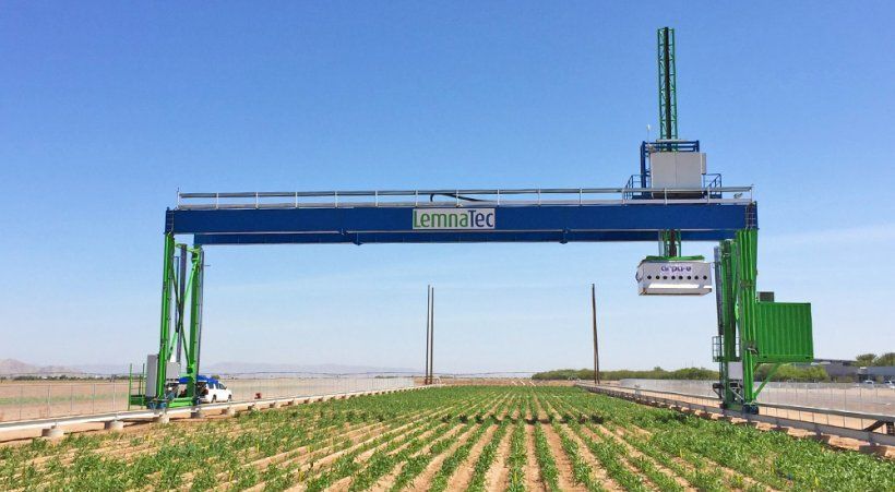
"The project was initially funded by the US government, and the robot, which is the size of a football field, measures 70ft high (about 21,3m), 92ft wide (28m), and 1 200ft (366m) long, the researchers said in a report on the Rothamsted Research website," the Farmer's Weekly reports.
"The tall metal structure supports a motorised measuring platform with multiple sensors, and is capable of monitoring crops within a 15m x 120m area. It is also fully automated and able to operate 24 hours/day throughout the year.
"The machine facilitates data collection through sensors that simultaneously and non-destructively analyses of plant growth, morphology and physiology, and the data obtained provides a detailed report about the plants’ growth and vigour."
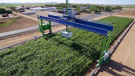
Phenotyping field scanner system
"The Lemnatec Field Scanalyzer at the University of Arizona Maricopa Agricultural Center and USDA Arid Land Research Station in Maricopa, Arizona is the largest field crop analytics robot in the world. This high-throughput phenotyping field-scanning robot has a 30-ton steel gantry that autonomously moves along two 200-meter steel rails while continuously imaging the crops growing below it with a diverse array of cameras and sensors," the TerraRef.org reports
Data Repositories Utilized: Weather, Sensor, and Trait Data
Automated controlled-environment phenotyping
The Bellwether Foundation Phenotyping Facility is a climate controlled 70 m2 growth house with a conveyor belt system for moving plants to and from fluorescence, color, and nearinfrared imaging cabinets. This automated, high-throughput platform allows repeated non-destructive time-series image capture and multi-parametric analysis of 1,140 plants in a single experiment.
Data Repositories Utilized: Sensor and Trait Data
Phenotyping sensors on Unmanned Aerial Vehicles
UAVs will repeatedly fly precision passes over crops to provide autonomous image surveys, with onboard sensors georegistering the data and stitching together the captured images based on vehicle positions. The use of UAVs will provide rapid coverage of areas that are much larger than what can be covered with ground-based systems.
Data Repositories Utilized: Sensor and Trait Data
Phenotyping sensors on piloted ground vehicles
Multiple vehicles outfitted with instruments that measure canopy height, temperature, and spectral reflectance at three wavelengths will be used to collect plot-level data georeferenced at centimeter accuracy. Plot scale data is relevant for traits that are strongly influenced by interplant competition and crop geometry such as light interception and canopy temperature.
Data Repositories Utilized: Sensor and Trait Data
Genomic and genetic data and computational platform
We will conduct whole-genome resequencing on a diverse set of 400 sorghum accessions included in the Bioenergy Association Panel to measure the landscape of genetic variation in the selected germplasm and provide whole-genome sequences for association mapping. In addition, we will conduct genotyping by-sequencing on 400 lines from two recombinant inbred line (RIL) populations. The genomic data will then be used to identify the differences between each line and the reference genome sequence for sorghum. We will use bioinformatics and quantitative genetics to characterize the observed genetic variation and identify genomic regions controlling biomass, plant architecture, and photosynthetic traits.
Data Repositories Utilized: Genomics Data
High performance data storage and computing system
The system will provide public access to raw data, metadata, derived data, provenance for derived data, and standardized data processing workflows. This open-source compute platform will be used to provide open access to huge datasets that will guide breeding decisions, facilitate collaboration, and allow unprecedented data sharing.
Data Repositories Utilized: Weather, Sensor, Trait, and Genomic Data, as well as software (github.com/terraref) and open computing (www.workbench.terraref.org).
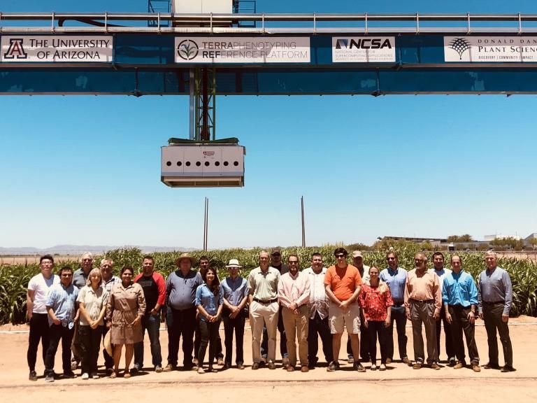
World’s Largest Robotic Field Scanner: Maricopa, Arizona
Address: 37860 W Smith Enke Rd, Maricopa, AZ 85138, United States
Facebook: The University of Arizona Maricopa Ag Center
Phone: +1 520-374-6380
website: https://mac.arizona.edu

